Amanda M. Castro is a Newsweek Live Blog Editor based in New York. Her focus is reporting on U.S. politics, breaking news, consumer topics, and entertainment. She specializes in delivering in-depth news and live blog reporting and has experience covering U.S. presidential debates, awards shows, and more. Amanda joined Newsweek in 2024 from the The U.S. Sun and is a graduate of the University of New Haven.
You can get in touch with Amanda by emailing a.castro@newsweek.com.
Languages: English, Spanish
Amanda Castro
and
Hannah Parry is a Newsweek Live Blog Editor based in New York. Her focus is reporting on U.S. politics and society. She has covered politics, tech and crime extensively.
Hannah joined Newsweek in 2024 and previously worked as an assistant editor at The U.S. Sun and as a senior reporter and assistant news editor at The Daily Mail. She is a graduate of the University of Nottingham. You can get in touch with Hannah by emailing h.parry@newsweek.com. Languages: English.
Hannah Parry
Live Blog Editor
Continuous updates; facts and sources are still being cross-checked.
✓ Link copied to clipboard!
- English (Original)
- Español
- 中国人
- Français
- Deutsch
- Portuguese
- हिन्दी
Newsweek AI is in beta. Translations may contain inaccuracies—please refer to the original content.
🎙️ Voice is AI-generated. Inconsistencies may occur.
Hurricane Erin intensified back to a Category 4 storm Sunday night, prompting a mandatory evacuation of Hatteras Island in North Carolina. Though the storm is not expected to make landfall, its expanding size and powerful winds pose serious threats to the Outer Banks, where officials declared a state of emergency. The National Weather Service warned that high surf, flooding tides, and gusty winds could render parts of Highway 12 impassable for days.
What to Know:
- Erin’s center is forecast to stay at least 200 miles offshore
- Hatteras Island evacuation begins Monday in Dare County
- Highway 12 may be washed out by surf and flooding tides
- Rip currents and waves over 20 feet expected along East Coast
- Erin’s winds reached 130 mph early Monday, with further strengthening possible
- Tropical storm warnings issued for Turks and Caicos, Bahamas as thousands remain without power in Puerto Rico
Stay with Newsweek as Hurricane Erin continues to evolve.
Tropical wave in Atlantic could develop into depression this week
While Hurricane Erin churns offshore, the National Hurricane Center is monitoring a separate tropical wave over the eastern Atlantic that could become the season’s next named storm.
Forecasters said Monday that the system is producing disorganized showers and thunderstorms, but environmental conditions appear favorable for gradual development. A tropical depression could form later this week as the wave moves west-northwest toward the Leeward Islands.
The system has a 50% chance of formation over the next seven days, according to the latest advisory.
Hurricane Erin triggers evacuations along North Carolina’s Outer Banks

Jamie Rhome, Deputy Director of the National Hurricane Center, looks at a screen showing paths that Tropical Storm Erin could take as they continue to track its progress at the National Hurricane Center on August…
Jamie Rhome, Deputy Director of the National Hurricane Center, looks at a screen showing paths that Tropical Storm Erin could take as they continue to track its progress at the National Hurricane Center on August 13, 2025, in Miami, Florida.
Joe Raedle/Getty Images
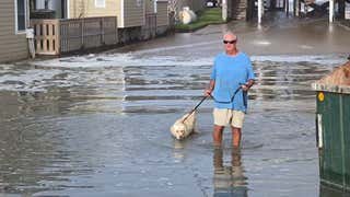
Dare County officials declared a state of emergency Monday as Hurricane Erin, though not expected to make landfall, expanded dramatically in size and threatened the fragile Outer Banks with dangerous surf and flooding.
Emergency managers ordered a mandatory evacuation of Hatteras Island, citing forecasts of high winds and waves that could breach portions of North Carolina Highway 12, the only road linking the island to the mainland. The National Weather Service warned that several days of pounding surf could render the route impassable.
While Erin’s center is projected to remain more than 200 miles offshore, its growing reach is expected to generate hazardous rip currents up and down the Eastern Seaboard.


