Tropical trouble could stir near Southeast beaches around 4th of July
An area stretching from the eastern Gulf to Atlantic waters of northeastern Florida, Georgia and the Carolinas is the zone AccuWeather meteorologists continue to watch for tropical development during the first part of July.
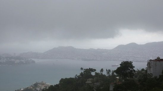
People heading to the southeastern United States beaches over the next few days should have little concern from a sudden tropical storm. However, there may be a general uptick in shower and thunderstorm activity, and weather and surf conditions may deteriorate more so on or shortly after the Fourth of July.

AccuWeather.com
The area has been on AccuWeather meteorologists’ radar for a couple of weeks now. As anticipated, a broad area of low pressure will form in the region later this week. Lowering atmospheric pressure is sometimes the first sign that tropical development is about to occur.
Next, as the pressure lowers in the region, spotty showers and thunderstorms in the hot and humid air will tend to organize in groups stretching from the eastern Gulf to the southern Atlantic and over the mainland of the southeastern U.S.
A third step toward tropical development would be if a more concentrated area of low pressure forms within the zone, especially if that occurs in response to one of the thunderstorm clusters.

AccuWeather.com
“Development may be a bit more likely on the Gulf side, as opposed to the Atlantic side of Florida, but at this point the entire zone is being watched,” AccuWeather Lead Long-Range Meteorologist Alex DaSilva said, “At this time we feel the development window is from around July 4 to early next week.”
Once a concentrated area of rain and thunderstorms develops, even without significant wind, AccuWeather meteorologists may declare the low pressure area a tropical rainstorm to give advanced tracking information and adverse weather conditions that could affect land.

AccuWeather.com
Should clustering of thunderstorms and lowering pressure develop enough spin around a center with winds of 35-38 mph, a tropical depression may be born. Waters are warm enough (80 F or higher) to allow and sustain tropical development.
Two tropical storms did not affect the US but the third might
During the last week of June, a cluster of thunderstorms associated with a broad area of low pressure evolved from a tropical rainstorm to a tropical depression and then Tropical Storm Barry, while over the southwestern Gulf of Mexico. Barry’s life only spanned several hours before moving onshore and losing wind intensity in eastern Mexico.
Several days earlier, Tropical Storm Andrea also had a short lifespan while over the central Atlantic, several hundred miles to the east-northeast of Bermuda.
The next name on the list of tropical storms for the 2025 Atlantic hurricane season is Chantal.

AccuWeather.com
Cool water and vast areas of dry air and dust are likely to continue inhibiting tropical development from Africa to the eastern Caribbean over the next week or more, and that is not unusual at this point of the season.

AccuWeather.com
AccuWeather meteorologists are expecting 11-16 more named storms this season, following Andrea and Barry.
The heart of the hurricane season is still approximately two months away. Despite the seemingly slow start to the Atlantic season, the formation of storms is still several weeks ahead of schedule.

AccuWeather.com
Eastern Pacific up to 6th named storm
Meanwhile, the eastern Pacific continues to be very active for so early in the season, with the sixth named storm on deck. Typically the sixth name storm does not form until early August and the average date for the first major hurricane not until mid-July.
Erick was the earliest fifth named storm on record and the earliest major hurricane to make landfall. Erick rapidly intensified to a Category 4 on the Saffir-Simpson hurricane wind scale with peak winds of 145 mph.
Tropical Storm Flossie recently formed off the southwest coast of Mexico as anticipated and will take a northwestern track that nearly parallels the Mexican coast this week, but with the eye of the storm just offshore. Flossie is expected to become a powerful hurricane for a time.

AccuWeather.com
Even with a track offshore, some rain, wind and seas will buffet Mexico’s Pacific coast. Should Flossie survive long enough, it could track directly onshore over the southern part of the Baja Peninsula.
Because Flossie will bring significant rain, wind, and rough seas, AccuWeather’s RealImpact™ Scale for Hurricanes is a 1 for Mexico.

AccuWeather.com
Enough rain may fall to trigger mudslides and flash flooding in some coastal areas. The AccuWeather Local StormMax™ rainfall for Flossie in Mexico is 14 inches.
Want next-level safety, ad-free? Unlock advanced, hyperlocal severe weather alerts when you subscribe to Premium+ on the AccuWeather app. AccuWeather Alerts™ are prompted by our expert meteorologists who monitor and analyze dangerous weather risks 24/7 to keep you and your family safer.